


 Manage booking
The Diamond Circle in North Iceland: Goðafoss, Mývatn, Húsavík and Ásbyrgi

Drive Reykjavik team · 10 min read · October 2026
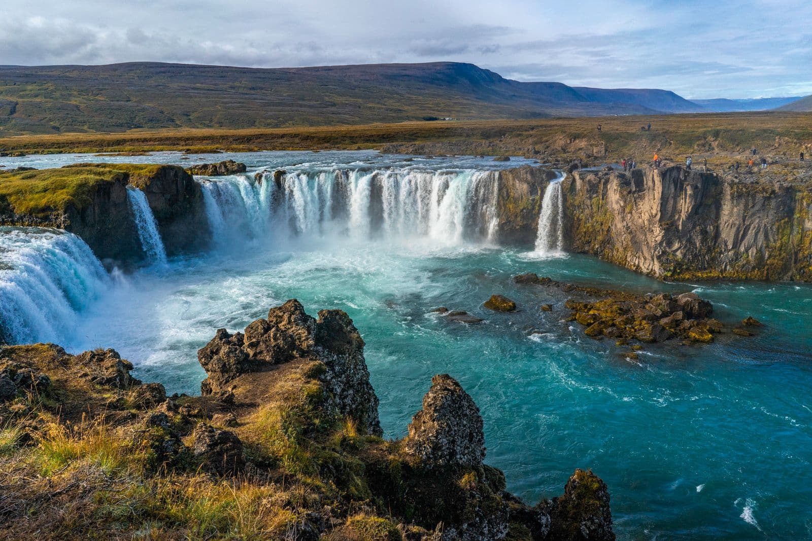
Most visitors to Iceland know the Golden Circle near Reykjavík. Far fewer know that the north has its own classic loop: the Diamond Circle, or Demantshringurinn in Icelandic. It links five headline sights in North Iceland: Goðafoss waterfall, Lake Mývatn, Dettifoss waterfall, the Ásbyrgi canyon and the harbour town of Húsavík. Along the way you pass lava fields, steaming geothermal ground, a deep river canyon and a bay known for whales.
The loop is roughly 250 km long and is usually started from Akureyri, North Iceland's largest town, or from a base near Mývatn or Húsavík. It can be driven in one long day, but it is more enjoyable over two, especially if you want time at Mývatn and a whale-watching trip from Húsavík. This guide explains each stop, the best order, how the seasons affect the route and how to get to the north in the first place.
The Diamond Circle route at a glance
The usual way to drive the loop from Akureyri is east along the Ring Road to Goðafoss and Mývatn, north-east to Dettifoss, north to Ásbyrgi, then west along the coast to Húsavík and back to Akureyri. You can also do it in reverse. Driving times below are approximate and assume good conditions.
- Akureyri to Goðafoss: about 35 to 40 minutes.
- Goðafoss to Lake Mývatn: around 40 minutes.
- Mývatn to Dettifoss: roughly an hour.
- Dettifoss to Ásbyrgi: around 30 to 45 minutes, depending on the road and the season.
- Ásbyrgi to Húsavík: about an hour along the coast.
- Húsavík back to Akureyri: around an hour and a quarter.
Add it up and the driving alone is around five to six hours, before any stops. That is why a one-day Diamond Circle is a long day of 10 hours or more, and why many travellers split it.
Goðafoss: the waterfall of the gods
Goðafoss is a wide, horseshoe-shaped waterfall on the Skjálfandafljót river, right beside the Ring Road between Akureyri and Mývatn. Its name means “waterfall of the gods”. According to tradition, around the year 1000, when Iceland adopted Christianity, the lawspeaker Þorgeir Ljósvetningagoði threw statues of the old Norse gods into the falls.
There are viewpoints and paths on both banks of the river, and you can walk from the car park to the edge in a few minutes. The east bank gives a classic front view, while the west bank brings you closer to the water. In winter the falls are framed by snow and ice, and the paths can be slippery, so wear shoes with good grip.
Lake Mývatn: craters, lava and steam
Lake Mývatn sits in an active volcanic area, and within a few kilometres you find pseudocraters, lava formations, a huge tephra crater and bubbling mud pots. It is easy to spend a whole day here, so on a one-day Diamond Circle you will need to choose.
- Skútustaðagígar: grassy pseudocraters by the lake, formed when lava flowed over wet ground. An easy path circles them.
- Dimmuborgir: a maze of lava pillars and arches with marked trails of different lengths.
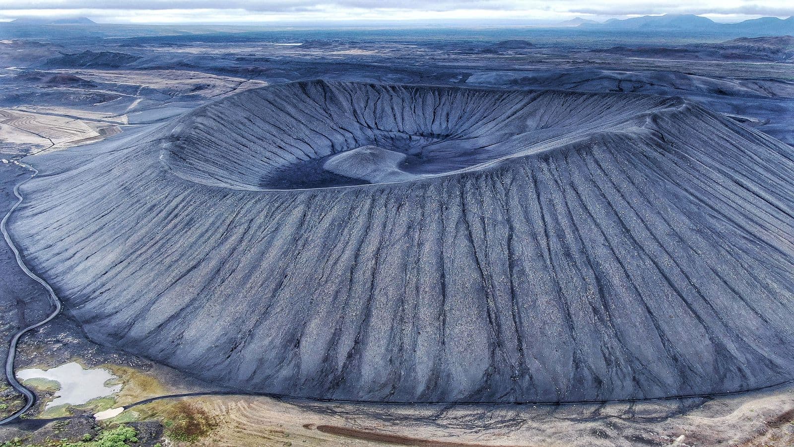
- Hverfjall: a large, almost circular tephra crater with a steep path to the rim and wide views.
- Hverir (Námafjall): steaming vents and boiling mud pools on orange ground, with a strong smell of sulphur.
- Mývatn Nature Baths: a geothermal bathing lagoon with milky-blue water. Check opening hours and book ahead.
The name Mývatn means “midge lake”, and on calm summer days the small flies can be noticeable near the water. Most of them don't bite, but a head net makes walks more comfortable. Our Lake Mývatn guide covers the area in much more detail.
Dettifoss and the Jökulsárgljúfur canyon
From Mývatn the route heads east, then north towards Dettifoss, one of the most powerful waterfalls in Europe. The glacial river Jökulsá á Fjöllum, fed by meltwater from Vatnajökull, thunders over a wide cliff into a grey canyon, throwing up spray you can feel long before you reach the edge. The area is part of Vatnajökull National Park.
Dettifoss can be seen from both sides of the river, and the two sides are reached by different roads. The west side is the one most visitors use on the Diamond Circle. The east side road is gravel and is generally closed in winter. A short walk upstream from Dettifoss brings you to Selfoss, a broad, lower waterfall that many people find just as beautiful.
Access to Dettifoss depends heavily on the season. In winter and early spring, roads and paths in the area can be closed or icy, and the stretch between Dettifoss and Ásbyrgi in particular is affected by snow. Always check current road conditions on the official Icelandic road information service before you set out, and be ready to change the order of the day or skip Dettifoss if the road is closed.
Ásbyrgi: the horseshoe canyon
Ásbyrgi is a horseshoe-shaped canyon with sheer cliffs and a floor of birch woodland, which feels very different from the bare lava landscapes elsewhere on the route. Geologists believe it was carved by enormous glacial floods of the Jökulsá á Fjöllum. Norse legend gives a more colourful explanation: it is the hoofprint of Sleipnir, the eight-legged horse of the god Odin.
From the car park at the inner end of the canyon, an easy path leads through the trees to a small pond below the cliffs. There is also a visitor centre at the mouth of the canyon, which is part of Vatnajökull National Park. Allow at least an hour to walk and enjoy the shelter of the trees.
If you have extra time, Hljóðaklettar, the “echo rocks”, are a fascinating area of twisted basalt formations further up the canyon of Jökulsárgljúfur. Reaching them takes more time and is easier in summer.
Húsavík: whales and a harbour town
Húsavík sits on Skjálfandi bay and is one of Iceland's best-known places for whale watching. Several operators run trips from the harbour, mainly in the warmer months, and humpback whales and other species are often seen in the bay. As with all wildlife, sightings are never guaranteed, and sea conditions decide whether boats sail. Check seasons, times and prices directly with the operators and book in advance in summer.
Even without a boat trip, Húsavík is a pleasant stop. The wooden church by the harbour is the town's landmark, there is a whale museum near the water, and the harbour has cafés and restaurants. The GeoSea geothermal sea baths on the headland above town have views across the bay; check their opening hours before you go.
From Húsavík the road heads back to Akureyri. On the way you can use the Vaðlaheiðargöng tunnel, which shortens the drive but is a toll tunnel with payment online, or take the older road over the pass.
One day or two? Planning the loop
The Diamond Circle in a single day is possible in summer, with long daylight and open roads, but it means short stops everywhere. Two days is more comfortable and lets you match activities to the weather.
In one day
- Start early from Akureyri and stop at Goðafoss on the way.
- Pick two or three stops at Mývatn, for example Hverir, Dimmuborgir and the pseudocraters.
- Visit Dettifoss from the west side, then continue to Ásbyrgi if the road is open.
- Finish in Húsavík for a late meal before driving back.
Over two days
- Day 1: Goðafoss and a full afternoon at Mývatn, ending with a soak at the nature baths. Stay near the lake.
- Day 2: Dettifoss in the morning, a walk in Ásbyrgi, then whale watching or the sea baths in Húsavík before returning to Akureyri.
By season
From roughly June to August you have very long days, the best chance that every road is open, and the main whale-watching season. Autumn brings colours and darker nights for the northern lights, but also the first snow. In winter, Goðafoss and Mývatn remain accessible on the Ring Road in normal conditions and are beautiful under snow, while Dettifoss and the road towards Ásbyrgi are often difficult or closed. Our guides to Iceland in winter and Iceland weather month by month explain what to expect.
What to bring
- Waterproof layers and a warm hat, even in summer, because the spray at Dettifoss and Goðafoss soaks you quickly.
- Shoes with good grip for wet rock and, in winter, icy paths. Many visitors bring slip-on ice cleats in the colder months.
- A swimsuit and towel if you plan to visit the Mývatn Nature Baths or the sea baths in Húsavík.
- Snacks and water, as services between Mývatn, Dettifoss and Ásbyrgi are limited.
- A head net for calm summer days at Mývatn.
Getting to North Iceland
Most international flights land at Keflavík Airport in the south-west, a long way from the Diamond Circle. The drive from Keflavík to Akureyri along the Ring Road takes around five to six hours without stops. You have a few options:
- Domestic flight: flights from Reykjavík's domestic airport to Akureyri take less than an hour. Our domestic airport transfers guide explains how to connect from Keflavík.
- Private transfer: we drive directly from Keflavík Airport to the north, door to door, with a fixed price per car. See the price to Akureyri, Goðafoss, Mývatn or Húsavík.
- As part of a longer trip: many travellers reach the north on a Ring Road trip. Our Ring Road planning guide helps you divide the days.
A long transfer is a good way to see the country on the way. Your driver meets you in the arrivals hall at Keflavík with a name sign, and if you would like short stops on the way, for example at Goðafoss before you reach Mývatn, agree them with us in advance. The price is the same day and night, and free cancellation is available up to 24 hours before pick-up. Groups of 8 to 16 can ask about a minibus on WhatsApp at +354 777 3949.
Once you are in the north, our Akureyri travel guide is a good companion for the town itself.
Frequently asked questions
It is a loop of roughly 250 km in North Iceland that links Goðafoss, Lake Mývatn, Dettifoss, Ásbyrgi canyon and Húsavík. It is often described as the north's version of the Golden Circle.
The driving alone takes around five to six hours, so a one-day trip with stops is usually 10 hours or more. Many travellers prefer to spread it over two days.
Partly. Goðafoss and Mývatn are usually accessible along the Ring Road in normal conditions, but roads to Dettifoss and Ásbyrgi are often difficult or closed in winter. Check road conditions each morning.
Akureyri is the most common starting point, but you can also base yourself near Mývatn or in Húsavík and drive the loop from there.
They are different. The Golden Circle is closer to Reykjavík and easy to fit into a short trip, while the Diamond Circle is quieter and more varied but requires getting to North Iceland first.
Whale-watching trips run from Húsavík harbour, mainly in the warmer months, and whales are often seen in Skjálfandi bay. Sightings are never guaranteed, so check with the operators.
You can take a domestic flight from Reykjavík to Akureyri or travel by road, which takes around five to six hours to Akureyri. We offer private transfers from Keflavík Airport to Akureyri, Mývatn, Goðafoss and Húsavík at a fixed price per car.
Travel tips
More in Places to visit


 Places to visit
Interstellar, Batman Begins and Star Wars: the Iceland glaciers and beaches on screen
Svínafellsjökull glacier, the black sands near Vík and Jökulsárlón: where Interstellar, Batman Begins and Rogue One were filmed in Iceland, and how to visit.
Read more Places to visit
Game of Thrones filming locations in Iceland you can visit
Þingvellir, Grjótagjá, Dimmuborgir, Svínafellsjökull, Reynisfjara and Kirkjufell: where Game of Thrones was filmed in Iceland and how to see each place.
Read more Places to visit
East Iceland guide: Egilsstaðir and the Eastfjords
Waterfalls, forests, basalt canyons and quiet fishing villages: a practical guide to Egilsstaðir and the Eastfjords, with what to see and how to get there.
Read more