


 Manage booking
Dettifoss and Selfoss: Visiting North Iceland's Mighty Waterfalls

Drive Reykjavik team · 7 min read · October 2026
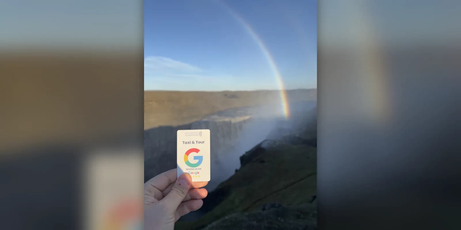
Dettifoss is the kind of waterfall you hear before you see it. The glacial river Jökulsá á Fjöllum drops about 44 metres across a front roughly 100 metres wide, and the ground hums under your feet. It is often described as the most powerful waterfall in Europe. A short walk upstream, Selfoss is lower and wider, with water pouring over a long horseshoe of basalt.
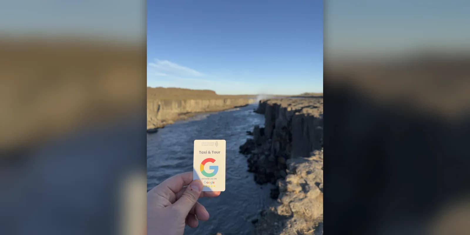
Both waterfalls are in the northern part of Vatnajökull National Park and belong to the route known as the Diamond Circle. We took the photos in this article on our own trip there, which is why our review card appears in them.
Dettifoss and Selfoss at a glance
- Where: Vatnajökull National Park (Jökulsárgljúfur), North-East Iceland.
- River: Jökulsá á Fjöllum, fed by the Vatnajökull glacier.
- Dettifoss: about 44 m high and roughly 100 m wide.
- Selfoss: about 11 m high, roughly 1 km upstream of Dettifoss.
- Easiest access: the west side, on paved Road 862 from the Ring Road.
- Time needed: about an hour and a half for both waterfalls.
- Best season: June to September.
- Entrance: free.
Why the water is grey
Jökulsá á Fjöllum is a glacial river. It begins under Vatnajökull, the largest glacier in Iceland, and carries fine rock ground down by the ice. That sediment gives the water its grey-brown colour, very different from the clear water of spring-fed rivers. The flow is strongest in summer, when the glacier melts fastest, and after heavy rain.
Over thousands of years the river, helped by huge glacial floods, has cut the Jökulsárgljúfur canyon downstream of the falls. Dettifoss is the largest of several waterfalls in it.
West side or east side?
You can reach Dettifoss from either bank, and the two sides are not connected at the falls, so you choose one before you set off.
- West side (Road 862): a paved road from the Ring Road, a large car park and marked paths to viewpoints over both Dettifoss and Selfoss. This is the easier side and the one most visitors choose.
- East side (Road 864): a gravel road that is usually open only in summer. You stand closer to the edge of the falls, but the road is rougher and the path is rocky.
The walk to Dettifoss and Selfoss
From the west car park it takes about 15 to 20 minutes on a marked, rocky path to reach the Dettifoss viewpoints. From there a path follows the canyon upstream to Selfoss, roughly one kilometre away. Allow about an hour and a half for the full loop with time for photos.
The spray from Dettifoss soaks the paths near the falls, and they can be icy well into spring. Wear waterproof layers and shoes with a good grip, and keep back from the unfenced edges.
What to wear and bring
- A waterproof jacket and trousers: the spray near Dettifoss reaches the path.
- Walking shoes or boots with a good grip, and ice grips for your shoes in spring and autumn.
- A warm layer, hat and gloves, even in summer. The canyon is exposed to the wind.
- Water and something to eat. There is no café at the falls.
- A cloth to wipe your camera lens or phone.
Facilities and services
The west car park has toilets in the main season, and that is all. There is no shop, café or fuel at the falls, and phone coverage can be patchy. The nearest services are at Lake Mývatn and at Ásbyrgi, so fill up and buy food before you leave the Ring Road.
Photography tips
- On sunny days a rainbow forms in the spray when the sun is behind you. From the west side that usually means the afternoon.
- A wide-angle lens, or the wide camera on your phone, is the only way to fit Dettifoss into one frame.
- Include a person on the path for scale. Without one, photos rarely show how large the falls are.
- Selfoss looks best from the path along the canyon rim, where the long line of the falls is visible.
- Stay well back from the edge when you are looking at a screen rather than your feet.
Getting there
Dettifoss is roughly an hour by car from Lake Mývatn and about two hours from Akureyri. From Reykjavík it is a full day of driving in each direction, so it belongs to a trip around the north rather than a day out from the capital. Distances are approximate and travel times depend on the season.
Most people combine the falls with other stops nearby. See our guides to Lake Mývatn and the Diamond Circle, and our Akureyri travel guide if you are starting from there.
Hafragilsfoss and Ásbyrgi
About two kilometres downstream of Dettifoss, Hafragilsfoss drops around 27 metres into the deepest part of the canyon. A viewpoint above it is reached by a short drive and walk, and far fewer people go there.
At the northern end of the national park lies Ásbyrgi, a horseshoe-shaped canyon with high cliffs, birch woods and a small pond. According to legend it is the hoofprint of Sleipnir, the eight-legged horse of the god Odin. There is a visitor centre with information about trails and conditions.
A one-day plan from Lake Mývatn
- Morning: the mud pools at Hverir, a few minutes east of the lake.
- Late morning: drive to the west side of Dettifoss and walk to Dettifoss and Selfoss.
- Afternoon: continue north to Ásbyrgi for a short walk in the canyon.
- Evening: return by the coast through Húsavík, known for whale watching, or the same way back to the lake.
That loop is the heart of the Diamond Circle. It is a full day, and in winter it is usually too much for the daylight available.
When to visit
Summer, roughly June to September, is the simplest time: both roads are usually open, the paths are clear and the days are long. In spring and autumn the west side is often still reachable, with snow and ice on the paths. In mid-winter access is uncertain and you should plan with a local driver or an organised trip. Our guide to Iceland in winter explains the conditions.
Getting there with a private driver
We have been driving travellers around Iceland for ten years, and we go everywhere in the country, not only where our price list ends. For a route in the north, for example from Akureyri to Mývatn and Dettifoss, message us on WhatsApp at +354 777 3949 with your dates and group size and we reply with a fixed price per car. See our private transfers.
- Fixed price per car, not per person
- Economy (Tesla) for 1 to 4 passengers, Van (Mercedes Vito) for 5 to 7, minibus for 8 to 16 on request
- 20% deposit online, the rest to the driver by card or cash
- Free cancellation up to 24 hours before pick-up
FAQ
About 44 metres high and roughly 100 metres wide. Selfoss, a short walk upstream, is about 11 metres high but much wider.
The west side has a paved road, a large car park and marked paths to both waterfalls, so it suits most visitors. The east side is on a gravel road that is usually open only in summer.
Allow about an hour and a half on the west side to see both waterfalls at an easy pace.
Sometimes. Winter service on the roads is limited and they can close because of snow, so check road conditions on the day and consider going with a local driver.
There is no entrance fee for the waterfalls. Check on site whether a parking or service fee applies when you visit.
It is often described that way, based on the volume of water and the height of the drop. The flow changes with the season and is highest in summer.
Roughly an hour by car from Lake Mývatn and about two hours from Akureyri, depending on the season and road conditions.
Yes. The opening scene of the film Prometheus (2012) was filmed at Dettifoss.
No. The river is fast, cold and full of sediment, and the banks are unfenced. Stay on the marked paths.
Travel tips
More in Places to visit


 Places to visit
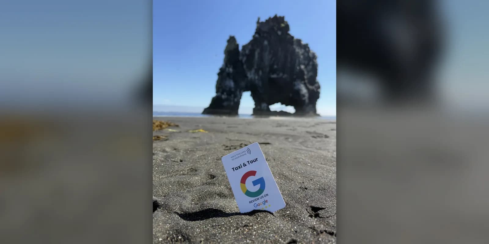
Hvítserkur: The Troll Rock of North-West Iceland
Hvítserkur is a 15-metre basalt sea stack on the Vatnsnes peninsula that looks like an animal drinking from the sea. How to get there, when to go and what else to see nearby.
Read more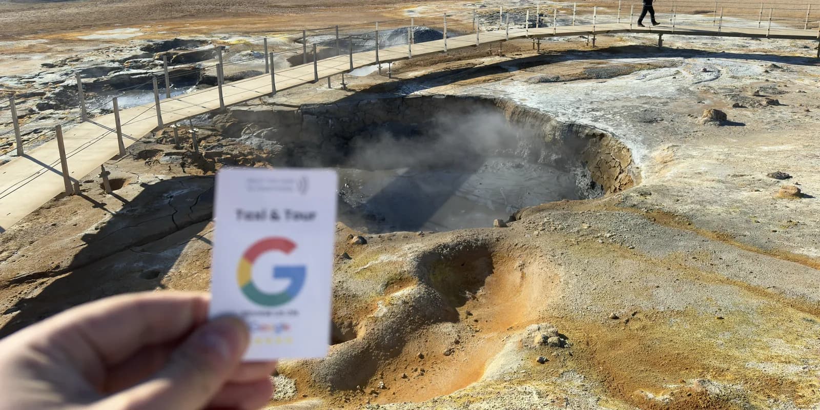 Places to visit
Hverir at Námafjall: Mud Pools and Steam Vents near Mývatn
Hverir is a field of boiling mud pools and hissing steam vents beside the Ring Road near Lake Mývatn. What to expect, how to stay safe and how long to allow.
Read more Places to visit
Diamond Beach: Ice on Black Sand at Jökulsárlón
At Diamond Beach, pieces of glacier ice wash up on black sand just across the road from Jökulsárlón. Where the ice comes from, the best light and how to visit safely.
Read more


