


 Manage booking
East Iceland guide: Egilsstaðir and the Eastfjords

Drive Reykjavik team · 10 min read · September 2026
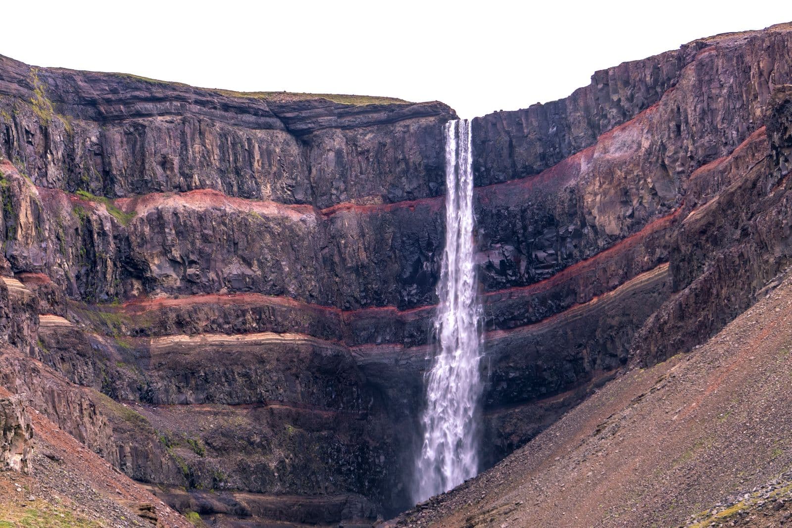
For many Ring Road travellers, East Iceland is the long stretch between the glaciers of the south and Lake Mývatn in the north. That is a shame, because the region has a lot to offer: the tall, red-striped Hengifoss waterfall, the basalt columns of Stuðlagil canyon, one of Iceland's largest forests and a row of small fishing towns tucked into deep fjords. It is also one of the quietest parts of the country.
This guide covers Egilsstaðir, the main town of the East, the sights within easy reach of it, and the Eastfjords from Seyðisfjörður in the north to Djúpivogur in the south. At the end you will find practical advice on seasons and on getting here from Keflavík Airport or Reykjavík.
East Iceland at a glance
East Iceland stretches from the highlands north of Vatnajökull to a coastline cut by narrow fjords. Inland, around the long lake of Lagarfljót, the landscape is surprisingly green and wooded. On the coast, steep mountains drop straight into the sea, and the road winds in and out of each fjord, passing villages that grew up around fishing and trade.
- Main town: Egilsstaðir, with shops, accommodation, a swimming pool and a domestic airport
- Ferry port: Seyðisfjörður, where the Norröna ferry from Denmark and the Faroe Islands arrives
- Wildlife: East Iceland is the only part of the country with wild reindeer, and they are sometimes seen near the roads
- Pace: fewer visitors than the south coast, and long distances between some sights
Most people need at least two or three days here to see the highlights without rushing. If you are passing through on a Ring Road trip, our Ring Road planning guide helps you decide how much time to give the East.
Egilsstaðir and Lagarfljót
Egilsstaðir is a young town by Icelandic standards. It grew up as a service centre at a crossroads, and it is still the practical hub of the region: this is where you stock up on supplies, fill the tank and find the widest choice of places to eat and sleep. The town itself is modest, but its setting on the banks of Lagarfljót, a long, narrow lake fed by glacial water, is lovely.
According to local folklore, Lagarfljót is home to a serpent-like creature, the Lagarfljót worm, and you will see references to it around the area. Whether or not you spot it, the lakeshore is pleasant for a walk.
Vök Baths
A few minutes from town, Vök Baths have geothermal pools floating on Lake Urriðavatn, with views across the water. It is a relaxing way to end a day of driving. Check current opening hours and book ahead in busy periods.
Hallormsstaðaskógur forest
South of Egilsstaðir, along the eastern shore of Lagarfljót, Hallormsstaðaskógur is one of the largest forests in Iceland, with birch woods, planted conifers, walking trails and picnic spots. In a country known for its open, treeless landscapes, it is a real change of scene, especially in autumn colours.
Hengifoss and Litlanesfoss
On the western side of Lagarfljót, Hengifoss is one of the tallest waterfalls in Iceland. What makes it special is the cliff behind it: dark layers of basalt separated by thin red bands of clay, formed between ancient lava flows. A path leads uphill from the car park to a viewpoint below the falls.
On the way up you pass Litlanesfoss, a smaller waterfall framed by tall basalt columns, which some visitors like even more than the main fall. The walk is steady and uphill rather than difficult, but wear proper shoes, as the path can be muddy or icy. Allow a good hour and a half for the return walk, more if you like to stop for photos.
Stuðlagil canyon
Stuðlagil, in the Jökuldalur valley north-west of Egilsstaðir, is a canyon lined with spectacular basalt columns, with a river running through it. It became widely known only in recent years, after a hydropower project upstream changed the flow of the river and revealed more of the canyon.
There are viewpoints on both sides of the river. One side has a viewing platform close to the road; on the other side a longer walk takes you down to the canyon floor for the classic view of the columns. In early summer the water is often a striking blue-green. Later in the summer it can turn greyer and higher when the reservoir upstream overflows, so the colour varies from year to year and week to week.
Stuðlagil is roughly an hour's drive from Egilsstaðir. Check the current access information and parking arrangements before you go, and stay on the marked paths, as the canyon edges are steep.
Seyðisfjörður and Borgarfjörður eystri
From Egilsstaðir, a road climbs over the Fjarðarheiði mountain pass and drops down to Seyðisfjörður, a colourful town at the head of a long fjord. It has old timber houses, an art centre, the pale blue church at the end of a rainbow-painted street, and the terminal for the Norröna ferry. Our Seyðisfjörður and Norröna guide covers the town and the ferry in detail.
Further north, Borgarfjörður eystri is a tiny village surrounded by colourful rhyolite mountains, known for walking trails and, in summer, for puffins. At the small harbour of Hafnarhólmi, a viewing platform lets you watch the birds at close range during the nesting season, roughly from spring to mid or late summer. Check current information before you go if puffins are your main reason for visiting.
The Eastfjords, village by village
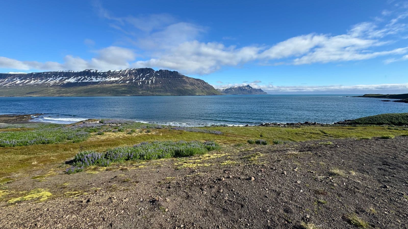
South of Seyðisfjörður, the coastal road links a series of fjord villages, several of them joined by tunnels. Each is small, but together they make one of the most scenic drives in the country. From north to south, these are the main ones.
- Neskaupstaður: a fishing town in Norðfjörður, reached through a road tunnel, with steep mountains above it and walking paths along the slopes.
- Eskifjörður: an old trading and fishing village beneath the jagged peak of Hólmatindur.
- Reyðarfjörður: at the head of the largest of the Eastfjords, home to a museum about Iceland during the Second World War.
- Fáskrúðsfjörður: a village with strong ties to the French fishermen who once worked off these coasts; street names are signed in both Icelandic and French.
- Stöðvarfjörður: known for Petra's Stone Collection, a private collection of stones and minerals gathered over a lifetime.
- Breiðdalsvík: a small village at the mouth of a wide, green valley.
- Djúpivogur: a harbour village below the pyramid-shaped mountain Búlandstindur, with a row of large stone eggs by the shore at Gleðivík.
Driving the coast takes longer than the map suggests, because every fjord adds kilometres. Give yourself a full day to drive from Egilsstaðir down to Djúpivogur with stops, rather than trying to squeeze it into an afternoon. If you are continuing south, our South coast to Höfn and Djúpivogur plan covers the next stretch.
Putting it together: a simple three-day plan
If you base yourself in or near Egilsstaðir, this plan covers the highlights at a relaxed pace. Swap the days around to suit the weather: keep the canyon for the clearest day and the baths for the greyest.
- Day 1: around Lagarfljót. Walk up to Litlanesfoss and Hengifoss, drive through Hallormsstaðaskógur and finish the day at Vök Baths.
- Day 2: canyon or puffins. Drive to Stuðlagil in the morning; in summer, you could instead head to Borgarfjörður eystri for the puffins and the coloured mountains.
- Day 3: the fjords. Cross Fjarðarheiði to Seyðisfjörður in the morning, then return and follow the coast south through Reyðarfjörður and Fáskrúðsfjörður, or as far as Djúpivogur if you are continuing your trip.
Distances are long and the weather can change quickly, so treat this as a starting point rather than a timetable. Cafés and shops in the smaller villages may keep short hours outside summer, so carry snacks and water on longer drives.
Getting to East Iceland from Keflavík or Reykjavík
East Iceland is about as far from Keflavík Airport as you can go on the Ring Road. By road it is a full day's drive, along the south coast via Vík and Höfn or through the north via Akureyri. There are three main ways to make the trip.
- Fly from Reykjavík's domestic airport to Egilsstaðir. The flight takes about an hour, but international flights land at Keflavík, so you first need to get into Reykjavík. Our domestic airport guide explains how.
- Drive yourself, ideally over two days with a night on the way, especially in winter. Read our guide to driving in Iceland in winter if you are travelling in the dark months.
- Take a private transfer from Keflavík Airport or Reykjavík directly to your accommodation in the East, with all your luggage in one vehicle.
Our transfers have a fixed price per vehicle: a Tesla or similar for 1–4 passengers or a Mercedes Vito van for 5–7, the same price day and night. At Keflavík, your driver meets you in arrivals with a name sign, checks your landing time from your flight number and waits up to 45 minutes for free. Stops on the way can be included if you agree them with us in advance, and child seats are free on request.
We also drive to Seyðisfjörður, Reyðarfjörður, Eskifjörður, Neskaupstaður, Fáskrúðsfjörður and Djúpivogur. For 8–16 people we can arrange a minibus on request; message us on WhatsApp at +354 777 3949, 24/7.
When to visit East Iceland
Summer (June to August) is the best time for most visitors. The roads are open, the days are long, the puffins are at Borgarfjörður eystri and the forests and valleys are green. Inland around Egilsstaðir, summer weather is sometimes drier and sunnier than in the south-west, though Iceland's weather is never guaranteed.
September and October bring autumn colours in Hallormsstaðaskógur and the first chances of northern lights, with fewer visitors. Some seasonal services start to close. Our autumn guide has more on this time of year.
Winter is quiet and beautiful, but it needs flexibility. Mountain passes such as Fjarðarheiði can be snowy or closed for a while in storms, daylight is short, and some roads in the region are not served in winter. If you are travelling with us, we watch the forecast and road conditions and will contact you if the timing needs to change.
Frequently asked questions
Yes, especially if you like quiet places. The region has Hengifoss, Stuðlagil canyon, large forests, wild reindeer and a string of fjord villages, with far fewer visitors than the south coast.
Two or three days lets you see Egilsstaðir, Hengifoss, Stuðlagil and some of the Eastfjords without rushing. If you are only passing through on the Ring Road, plan at least one night in the region.
It is a full day's drive along the Ring Road, either through the north via Akureyri or along the south coast via Höfn. A domestic flight from Reykjavík to Egilsstaðir takes about an hour.
Early summer often gives the clearest blue-green water. Later in the summer the river can rise and turn greyer when the reservoir upstream overflows, so the colour varies.
At Hafnarhólmi in Borgarfjörður eystri, where a viewing platform lets you watch the birds during the nesting season, roughly from spring to mid or late summer.
Yes. Wild reindeer in Iceland live only in the East, and they are sometimes seen near the roads, especially outside the summer months.
Yes. We drive from Keflavík Airport or Reykjavík to Egilsstaðir and the Eastfjords at a fixed price per vehicle, with stops on the way if you agree them in advance.
Travel tips
More in Places to visit


 Places to visit
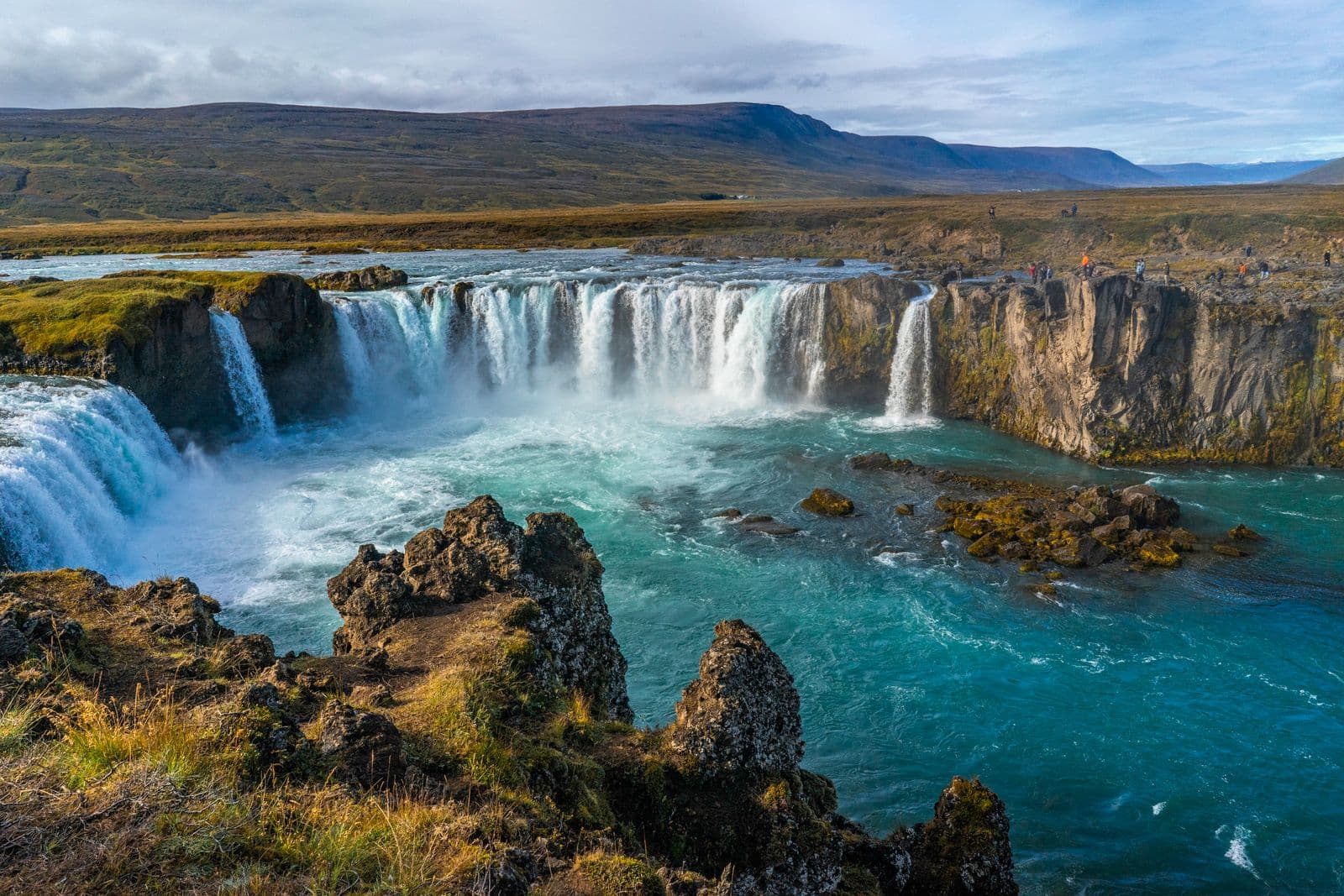
The Diamond Circle in North Iceland: Goðafoss, Mývatn, Húsavík and Ásbyrgi
North Iceland's answer to the Golden Circle: Goðafoss, Lake Mývatn, Dettifoss, Ásbyrgi canyon and Húsavík. Route, timings, seasons and how to get there.
Read more Places to visit
Interstellar, Batman Begins and Star Wars: the Iceland glaciers and beaches on screen
Svínafellsjökull glacier, the black sands near Vík and Jökulsárlón: where Interstellar, Batman Begins and Rogue One were filmed in Iceland, and how to visit.
Read more Places to visit
Game of Thrones filming locations in Iceland you can visit
Þingvellir, Grjótagjá, Dimmuborgir, Svínafellsjökull, Reynisfjara and Kirkjufell: where Game of Thrones was filmed in Iceland and how to see each place.
Read more